The principle of determining the corrections of any compass ΔK is to compare the compass direction (measured with a compass) with the true direction:
ΔK = IR - KK; ΔK = IP - KP.
There are three main methods for determining the compass correction:
-compared bearings;
- on alignment;
- by comparison of compasses.
Determination of ΔK by comparison of bearings
The method is based on the exact knowledge of the ship's position and the coordinates of the direction-finding landmark.
The true bearing is calculated, the bearing is found (KP).
The resulting CP is compared with the IP:
ΔK = IP - KP.
tgIP = Δλ cosφm/Δφ,
where: Δλ is the difference in longitude between the vessel and the landmark;
Δφ is the difference in latitude between the vessel and the landmark;
φm = 0.5(φ1 + φ2) is the average latitude.
IP can also be measured on the map, however, this will add measurement errors using a gasket tool.
Determination of ΔК by alignment
A system of two or three beacons, signs, lights located on the ground in a certain order and forming a line of position (axis of alignment) is called a sea navigation alignment.
The alignments are mainly designed to ensure navigation along straight sections (elbows) of fairways in narrow areas, where there are many navigational hazards.
By appointment, the alignments are leading, rotary, secant and deviation
The method for determining the compass corrections along the alignment consists in comparing the CP measured on the alignment marks at the moment of crossing the alignment line with the alignment index indicated on the map:
ΔK = IPstv - Kstv.
To determine ΔK, you can also use the alignment of two natural landmarks shown on the map (mountain peaks, capes) or structures (pipes, masts), the IP of which is measured on the map using a plotting tool.

Determination of ΔK by comparison of compasses
The method is based on comparing a compass heading whose correction is determined with a compass heading whose correction is known. Based on the simultaneous comparison of rates, ΔK is calculated.
ΔK = Ko + ΔKo - K *,
where Ko is the compass heading, the correction of which is known;
ΔKo is a known correction;
K - compass heading, the correction of which is determined.
The difference Ko - K \u003d R is called comparison. From here
ΔK = R + Ko.
Example:
Determine ΔMK if KKmk + 6º, GKK = 354º, ΔGK = -2º.
Solution:
R \u003d Ko - K \u003d GKK - KKmk \u003d 354º - 366º \u003d -12º;
ΔK = R + Ko;
ΔMK = R + ΔGK = (-12) + (-2) = -14º.
Answer: ΔMK = -14º.
Formula output *:
IR = K + ΔK; IR = Ko + ΔKo; because IR = IR, then
K + ΔK = Ko + ΔKo; ΔK = Ko + ΔKo - K.
Determination of the gyrocompass correction
In order to reduce random errors, after the gyrocompass arrives at the meridian (at the parking lot), multiple bearing measurements are made every 10 - 15 minutes for 2.5 - 3.0 hours. Based on the measurement results, the average value of the GKP gyrocompass bearing is calculated:
GKPav = 1/p(GKP1+GKP2+GKP3+…+GKPp);
where n is the number of measurements.
Then the constant correction is determined:
ΔGK \u003d IP - GKPav.
At sea, the constant correction of the gyrocompass is determined at uniform motion vessel. At the time of each measurement of the compass bearing, a high-precision observation is performed, relative to which the true bearing is calculated. For each gyrocompass bearing, the corresponding IP and the gyrocompass correction ΔGK are calculated. The average value of the correction is calculated by the formula
ΔGKav = 1/p(ΔGK1+ΔGK2+ΔGK3+…+ΔGKp);
where n is the number of measurements.
Determination of the magnetic correction
compass
The magnetic compass correction depends on the magnetic declination d and the deviation δ:
ΔMK = d + δ.
The declination changes with the ship's coordinates and over time, the deviation depends on the ship's heading.
Therefore, ΔMK, determined by comparing bearings, by alignment and by comparison, can only be used on the course on which it was determined.
In the general case, the correction of the magnetic compass is defined as the algebraic sum of the magnetic declination d, which is taken from the navigational sea chart and reduced to the year of navigation and the deviation δ, selected from the deviation table.
Constant keeping of the dead reckoning of the ship's path is a necessary condition for its safe navigation, therefore, control over the accuracy of heading, constant clarification and accounting of the compass correction is the most important and responsible task of the navigator. This work is constantly carried out both in the port and at sea.
To determine the correction of any compass, it is necessary to compare the true and compass directions to the same landmark, i.e.:
ΔMK (ΔGK) \u003d IP - KP.
Some ways to determine compass corrections are listed below.
Determination of the compass correction on the alignment. IP of the target is removed from the map. KP is taken at the moment of crossing the leading line.
Determination of the compass correction by coastal natural alignments (for example, sections of two capes). At the moment of crossing the line of natural alignments, the compass bearing is taken and compared with the direction of the line taken from the map passing through the sections of the two capes.
Determining the compass correction from the bearing of a distant landmark. This method is used when the vessel is anchored, when the place of reference and parking is precisely known. In this case, it is necessary to take into account the yaw of the vessel on the anchor chain under the influence of the wind and, especially, the alternating current
Determining the correction of a compass by comparison with another compass whose correction is known. The method is used to determine the correction of the main and traveling magnetic compasses by comparing the readings with a gyrocompass, the correction of which is known. On command, two observers simultaneously notice the course on both compasses. Determine:
∆MK = (GKK + ∆GK) - KK.
Determining the compass correction when determining the ship's position using three bearings. When determining the ship's position using three bearings, the so-called error triangle may appear, i.e. the laid position lines do not intersect at one point. When there is confidence in the correct identification of landmarks and in the absence of gross errors in bearings, and the triangle turns out to be large, this indicates an error in the accepted compass correction. To eliminate such an error, and at the same time determine the current compass correction, proceed as follows:
- all bearings are changed by 3 0 -5 0 in one direction or another, and after laying a new triangle of errors is obtained;
- lines are drawn through similar vertices of the old and new triangles of errors, and the point M of their intersection is taken as the observed position of the vessel, free from the influence of a systematic error in the compass correction ∆K;
- point M is connected to landmarks on the map and the obtained true bearings are measured with a protractor. Comparing them with the compass bearings of the same landmarks, they find three compass correction values ∆K = IP - KP. The arithmetic mean of the results obtained is taken as the actual correction for this course.
The principle and methodology for determining the compass correction from the observations of the luminaries.
On the high seas, the only way to determine the heading correction is the astronomical method. It is advisable to use it in the port, as compared to other methods, it is the most accurate and reliable.
When determining the compass correction in an astronomical way, the bearing to the luminary, measured using a direction finder, is used as the compass direction, and the calculable azimuth of the given luminary, calculated at the time of measurement in a tabular or machine way, is used as the true direction.
The following conditions must be observed:
1. Use for clarification ∆ To luminaries at low altitude (h< 30°) и вблизи диаметральной плоскости судна (КУ< 30°);
2. Measurements should be made in series of 3-5 bearings with direction finder refixation;
3. The bearing is measured with an accuracy of 0.1 °, the moments of measurements are recorded with an accuracy of no worse than 2-3 s;
4. The calculated azimuth must be converted into a circular account, i.e. IP = Ak.
There are several ways to determine Δ To the luminaries:
1.Definition Δ K according to the luminary located at an arbitrary azimuth;
2.Definition Δ K by the Sun at the time of its true rising and setting;
3. Determination of DK from observations of the Polar Star.
The first method is the main and most common, the other two are its special cases.
An example of compass comparison calculations As a result of comparing compasses in 2010, the following data were obtained: GKK = 310.5˚; KK = 306.5˚; ΔGK = - 1.3˚; magnetic declination of the map (dк) = 0.8˚Е 2000; annual change in magnetic declination (Δd) = 0.02˚ to W; δ = + 1.5˚. 1. Let's bring the magnetic declination to the year of navigation. To do this, it is necessary to multiply the difference between the year of navigation (N PL) and the year to which the declination on the map is assigned (N K) by the value of the annual change in magnetic declination. The sign of the product is determined by the sign of the annual change in magnetic declination. If the magnetic declination changes to E, then the product will have a + sign. If the magnetic declination changes to W, then the product will be negative. To obtain the value of the magnetic declination corresponding to the year of navigation (d), it is necessary to add the resulting product with its own sign to the declination of the map (d K). In our case, d \u003d (N PL - N K) × Δd + d K \u003d (2010 - 2000) × (−0 0.02) + 0 0.8 \u003d 0 0.6 E. 2. Calculate the true course according to the magnetic compass. IR MK \u003d KK + d + δ \u003d 306 0.5 + 0 0.6 + 1 0.5 \u003d 308 0.6. 3. Calculate the true heading using the gyrocompass. IC GK \u003d GKK + ΔGK \u003d 310 0.5 + (−1 0.3) \u003d 309 0.2. 4. Calculate the difference in absolute value between the true heading according to the gyrocompass and the true heading according to the magnetic compass. Δ \u003d IC GK - IC MK \u003d 309 0.2 - 308 0.6 \u003d 0 0.6, Δ \u003d 0 0.6. 5. Since the difference in absolute value between the true courses does not exceed three degrees, the accuracy of the course indicators can be considered satisfactory. 1. Determining the correction of the magnetic compass and monitoring its operation at sea 1. 1. General provisions The magnetic compass is simple in device, it is autonomous and reliable. The main disadvantage is the low accuracy in determining directions. Errors reach 2–4°, especially when rolling. Sources of errors: magnetic declination, deviation, inertia and insufficient sensitivity of the system of magnetic needles to the Earth's magnetic field. The magnetic compass card arrives at the meridian 3-4 minutes after maneuvering.
 Important in navigation is the exact knowledge of the deviation of the magnetic compass. The deviation is destroyed at least once a year by the methods studied in the course " Technical means navigation". The residual deviation is determined by navigation methods and should not exceed a few degrees. In accordance with good maritime practice, the deviation of the magnetic compass is determined: – at least once a year; – after repair, docking, demagnetization of the ship, as well as after loading and unloading cargo that changes the ship's magnetic field; – with a significant change in magnetic latitude; - when the deviation of the tabular deviation from the actual one is more than 1 ° for the main compasses and 2 ° for the traveling ones; before a long flight.
 All methods for determining the deviation are based on the use of the formula (4. 6) MP \u003d KP + δ → δ \u003d MP - KP The deviation depends on the course of the vessel, therefore it is usually determined on 8 equally spaced compass courses, and intermediate values are found by linear interpolation. Usually these are courses corresponding to the main and quarter points, i.e. courses 0, 45, 90, 135, 180, 225, 270, 315 degrees
 It is assumed that the ship's magnetic field is symmetrical with respect to the vessel's DP, i.e., the deviation is symmetrical with respect to the magnetic meridian, so the average value of the compass bearing to a distant object, taken to a distant landmark on equally spaced courses, can be taken as an estimate of the magnetic bearing. The formula will look like this: MP \u003d ∑KPi / 8 + A (5. 1) Where A is some correction for a systematic error (constant deviation), which is determined for a particular compass during the destruction of the deviation.
 1. 2. Methods for determining deviation 1. 2. 1. Along the alignment The vessel crosses the alignment on 8 equally spaced compass courses, and the navigator takes CPi. The compass courses are 45 degrees apart. Magnetic bearing is calculated by the formula MP = IP - d (5. 2)
 The value of IP and magnetic declination is removed from the map. Magnetic declination leads to a sailing year. When maneuvering in the vicinity of the alignment, the inertial characteristics of the magnetic compass should be taken into account. If the magnetic declination is unknown, then use the formula (5. 1) - then calculate the deviation on each course: δi \u003d MP - KPi (5. 3) and make a table or graph of the deviation as a function of the compass heading. The table is compiled in 10 about at the compass course.
 1. 2. 2. According to a remote landmark The ship circulates at a distance D from the navigational landmark and takes bearings at 8 equally spaced compass courses. Determine δ by the formula (5. 3). The magnetic bearing can be calculated using the formula (5. 2) or using the IP and d taken from the map.
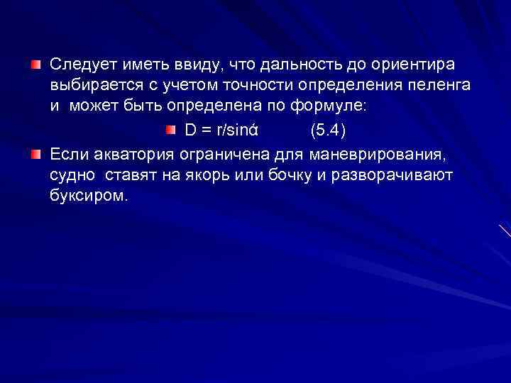 It should be borne in mind that the range to the landmark is selected taking into account the accuracy of determining the bearing and can be determined by the formula: D = r / sinά (5. 4) If the water area is limited for maneuvering, the ship is anchored or barreled and turned by tug.
 1. 2. 3. According to the bearing of the star The method is similar to that described above. On eight compass courses, the compass bearings of the luminary are determined. Then its azimuth (IP) is calculated using astronomical formulas, and, knowing the declination (from the map), the MP is obtained. The formula (5. 3) is used to calculate the deviation. To improve the accuracy of direction finding, a luminary located at a low altitude (no more than 30 degrees) is chosen. An essential advantage of the method is that, due to the great distance of the luminary, the accuracy does not depend on the coordinates of the vessel, i.e., there is more room for maneuvering.
 1. 2. 4. By comparison with another magnetic compass or gyrocompass. To compare compasses is to simultaneously notice their readings. Comparisons produce a steering compass with the main or gyrocompass. It is usually produced in 8 equally spaced courses. The deviation is determined by taking into account the equality of magnetic courses obtained from different heading indicators. For example, when comparing a traveling compass with the main one or when comparing it with a gyrocompass, the expressions are correct: KPp + δp \u003d KKgl + δgl (5. 5) Kpp + δp \u003d GKK + ΔGK - d (5, 6) From these ratios calculate the unknown
 1. 2. 5. Using the method of mutual bearings (in extreme situations) A magnetic compass installed on the shore or on a non-metal boat is taken from the ship, and the compass installed on the ship is synchronously taken from the shore or from the boat. It is clear that the MP is taken from the compass on the shore or on the boat. The deviation is determined by: δi = (180 o + MP i) - KP i (5. 7)
 2. Determining the correction of the gyrocompass and monitoring its operation at sea 2. 1. General Provisions Gyrocompasses develop a heading with an accuracy of 0.5 ° (with a probability of 95%) with a constant heading and roll of no more than 2 degrees. With increased pitching and intensive maneuvering, the gyrocompass error can reach 4 °. Due to inertial errors, highest accuracy measurements can be achieved 30 -40 minutes after the end of the maneuver. The gyrocompass has its own systematic errors, which must be compensated for by corrections. The formulas used to calculate famous formulas: ΔK = IK - KK (5. 8) ΔK = IP - KP (5. 9) Where ΔK, KP are the general designations for compass correction, compass heading and compass bearing, measured using a magnetic or gyrocompass.
 The task is reduced to determining the true directions, which are usually removed from the map or calculated by astronavigation methods, if direction finding of the luminaries is carried out.
 2. 2. Methods for determining the gyrocompass correction 2. 2. 1. Based on the bearing of a distant object The method is used if the ship is moored. The exact coordinates of the compass are determined on a map or plan and the IP is taken to a remote known navigation landmark.
 For about an hour and a half, they take the bearing to this landmark after 1015 minutes, find the correction according to the formula (5. 9) with each direction finding, and then derive its average value (line aa "). This will be the so-called constant correction of the Civil Code. Such an operation is also should always be carried out after a new launch of the GC, when he entered the meridian ΔGC a a" ΔGCi ΔGCav ΔGCi t
 2. 2. 2. According to the bearing of the navigational alignment, the IP of the alignment is indicated on the map. Having taken the direction of the target and comparing the IP with our HKP, we get ΔGK (formula (5. 9)). With this method, you can use not only artificial, but also natural alignments. 2. 2. 3. Using the true bearing of the star To do this, you need to find the direction of the star, calculate its azimuth (A), and this is the same as the IP. Comparing GKP and A, we get ΔGK. The most common method for determining ΔGK is by the bearing of sunrise and sunset, by the bearing of the Polar Star. In more detail, the definition of ΔGK by heavenly bodies studied in the course "Nautical Astronomy".
 2. 2. 4. By comparison with the course indicator, the amendment of which is known. In this case, the formulas obtained by equating the IC are used: KKp + ΔMKp = KKgl + ΔMKgl (5. 10) KKp + ΔMKp = GKK + ΔGK (5. 11) Equation (5. 10), (5. 11) are solved with respect to the unknown correction . These formulas are used when switching from one compass to another if any of them fails.
 If the instant correction of the gyrocompass, determined by one of the methods at sea, differs by more than 1 ° from the constant correction, determined in the port, then the alarm should be sounded. Determining the compass correction is one of the most important duties of a boatmaster. The rules of the navigation service prescribe to determine the compass correction whenever possible. Comparison of gyroscopic and magnetic compasses is made once during the watch (4 hours), if the heading does not change and with each change of heading. This is necessary in order to know the current compass correction in case of failure of the gyrocompass.
 Conclusions: 1. 2. 3. Determining the corrections of course indicators is one of the most important duties of the navigator. The compass correction should be determined whenever possible. The methods used to determine the correction of the magnetic compass and the gyrocompass are the same, namely: by alignment, using the bearing of the luminary, by the bearing of a remote landmark, by comparison with the heading indicator, the correction of which is known. But it should be remembered that the correction for the gyrocompass determined in this way is constant on all courses. For a magnetic compass, this correction is correct only on this heading. Comparison of gyroscopic and magnetic compasses is made once during the watch (4 hours), if the heading does not change and with each change of heading.
 The content of the issues considered at the seminar 1. The main points, lines and planes for orientation to earth's surface. 2. Horizon division systems: rhumb, circle, semicircle and quarter 3. Directions relative to the plane of the true meridian and the center plane of the ship 4. Use of a magnetic compass, magnetic declination, magnetic compass deviation, magnetic compass correction. 5. Correlation between compass and true directions 6. Methods for determining the corrections of heading indicators 7. Calculation of directions using a gyrocompass and a magnetic compass
The calculation of true directions from known compasses is called correctiontowardsny(rooms). Correction of the points is necessary for plotting a course or bearing line on the map. By choosing b from the table using the known QC, one can first find the magnetic directions using dependence (15), and then the true ones using relation (13). Substituting (15) into (13), we obtain formulas for correcting points
![]() (23)
(23)
The calculation of compass directions from known true ones is called translationtowardsny(rooms). Rumba translation is necessary, for example, to determine the ship's course by compass in order to move from one point to another. First, according to (14), the magnetic course is calculated
MK=IR - d,
and then by (16) find the compass heading
The deviation is selected from the table according to the magnetic course, given that the MC and CC differ by a small amount. In cases where the deviation exceeds 4°, and the tabular interval is 1°, it is advisable to make a second approximation. To do this, after calculating the QC, they again enter the deviation table already with the obtained value of the compass course, find b and calculate the compass course a second time.
Substituting (14) into (16), we obtain the dependences of the direct translation of points
![]() (24)
(24)
The algebraic sum of declination and deviation geometrically represents (Fig. 15) the angle in the horizon plane between the northern part of the true and compass meridians, called the compass correction (ΔMK),
ΔMK = d + δ. (25)
If the northern part of the compass meridian deviates to E from the true one, the compass correction is positive, if to W it is negative.
Taking into account dependence (25), from (23) and (24) we obtain formulas for correcting and translating points with a known compass correction:
![]() (26)
(26)
![]() (27)
(27)
All problems of correcting and translating points can be checked graphically (Figure 16).
To do this, for example, first build the true meridian, then by known values (ΔMK, d or IR) draw other lines (compass, magnetic meridian or heading) and determine unknown values. The location of the meridians relative to each other is determined by logical reasoning, taking into account the sign and magnitude of δ, d or ΔMK. Graphic control is carried out in order to eliminate errors in signs.
Correction and translation of points is most often done by calculating the compass correction using formulas (26) and (27), for which the declination value is removed from the map, and the deviation is selected from the table.
The reliability of the compass correction determines the accuracy of determining the true directions, and, consequently, the accuracy of the ship's wiring. Hence the need for systematic monitoring of the correction. The compass correction is determined by comparing the true and compass directions. To this end, it is necessary to know the value of the true heading or bearing and at the same time measure the corresponding compass heading. From (26) we have that
![]() (28)
(28)
To determine ΔMK, methods similar to those for determining deviation can be used: by bearings of the alignment, the true direction of which is given on the map or can be removed from the map; according to the bearing of a distant object, when the position of the ship is known with high accuracy, and the object is plotted on the map, according to the bearings of celestial bodies. On some river boats, where it is not possible to measure the bearing from a magnetic compass, the correction can be determined by comparing the IR and CC when sailing along the alignments, the direction of which is known. To do this, being on the alignment line, lead the ship with its nose exactly on the alignment marks and notice the compass course.
The correction of the magnetic compass can also be obtained by comparison with the gyrocompass, if its correction is known:
ΔMK = GKK - KK + ΔGK. (29)
For each determination of the magnetic compass correction, the deviation should be calculated using the formula
δ = ΔMK - d (30)
to control the validity of the table.
Vessel course - the angle between the centreline of the vessel and the direction to the north. Measured in degrees clockwise from 0° to 359°. Vessel's true heading (IK) is the angle enclosed between the northern part of the true meridian (lines NS) and the centreline of the ship (the direction of the bow of the ship). True heading is counted clockwise from 0 to 360°.
Magnetic heading (MK) is the angle between the magnetic northern meridian N and the heading line.
The operation of a magnetic compass is based on the property of a magnetic needle to occupy a certain position in the earth's magnetic field, namely: the northern end of the magnetic compass needle points to the earth's north magnetic pole N. Magnetic and geographic poles do not coincide. The direction passing through the axis of the magnetic needle is called the magnetic meridian. The magnetic meridian does not coincide with the direction of the true meridian. Compass heading (KK) called the angle in the plane true horizon, counted from the north part of the compass meridian clockwise to the bow of the ship's centreline. Compass courses and bearings can range from 0° to 360°.
Magnetic declination (d)- the angle between the northern part of the true meridian and the northern part of the magnetic meridian, is called magnetic declination. The declination is measured from the northern part of the true meridian to the east or west from 0 to 180°. The eastern, or core, declination is assigned a plus sign, while the western, or west, is assigned a minus sign. The magnetic declination for a given place is not constant, it is constantly increasing or decreasing by a small constant value. The magnitude of the declination in a given navigation area, its annual increase or decrease in the year to which the declination is given, are indicated on navigational charts. Magnetic compass deviation (δ)
call the horizontal angle by which the plane of the compass meridian deviates from the plane of the magnetic meridian (the difference between Nm and Nk). On each course, the deviation of ship compasses is different. This is due to the fact that when the course changes, the position of the ship's iron relative to the magnetic needles of the compass changes. In addition, after turning the ship, the ship's iron is partially remagnetized, which also leads to a change magnetic field vessel.
Magnetic compass correction- the algebraic sum of the deviation and magnetic declination, by which the compass directions differ from the true ones: ΔMK=δ+d MK deviation and declination must be taken with their own signs.
In order to find the true heading (IR) knowing the magnetic heading (MK) and the declination d of the compass in a given navigation area, it is necessary to algebraically add the declination reduced to the year of navigation with its sign to the magnetic heading: IR=MK+(±d) hence: MK=IR-(±d)
Example:True heading (IR) = 90°Deviation (δ) = 5°E (deviation to the east (E) sign “+”, if to the west (W) sign “-“)Declination reduced to the year of navigation (d) = 10 ° W (we have a declination to the west, then the sign will be “-”, i.e. -10 °)1) Find ΔMKΔMK=δ+d=5+(-10°)=-5°2) Find MKMC=IR-(±d)=90°-(-10°)=100°3) Find QCQC=IR-(±d)-(±
δ
)=
90°-(-10°)-(+5°)=95°
For clarity of calculations, I will make a sketch, since the example is interesting: 
It is also necessary to remember that: a) the heading does not have negative values, if such is obtained during calculations, the result should be subtracted from 360 °; b) if the heading turned out during calculations more than 360 °, then 360 ° should be subtracted from the result.